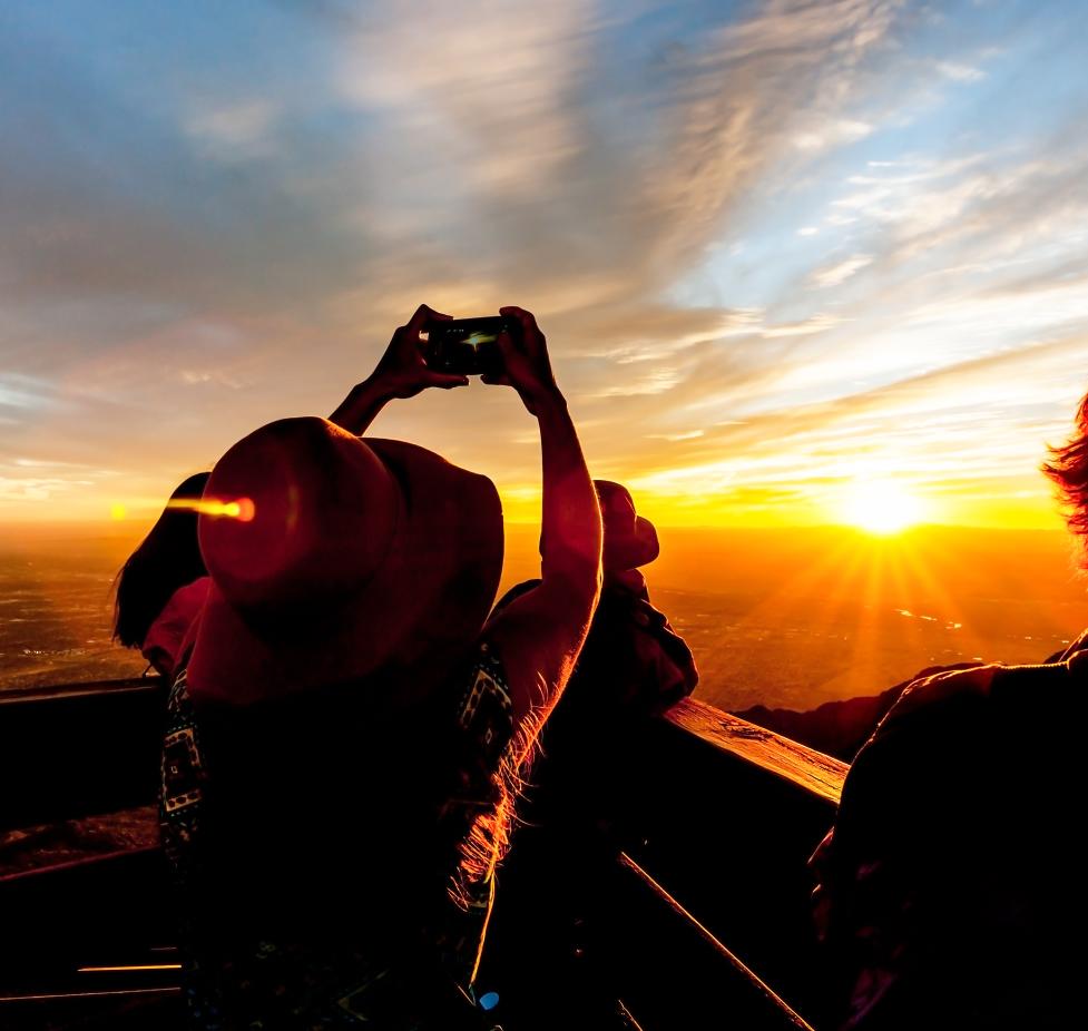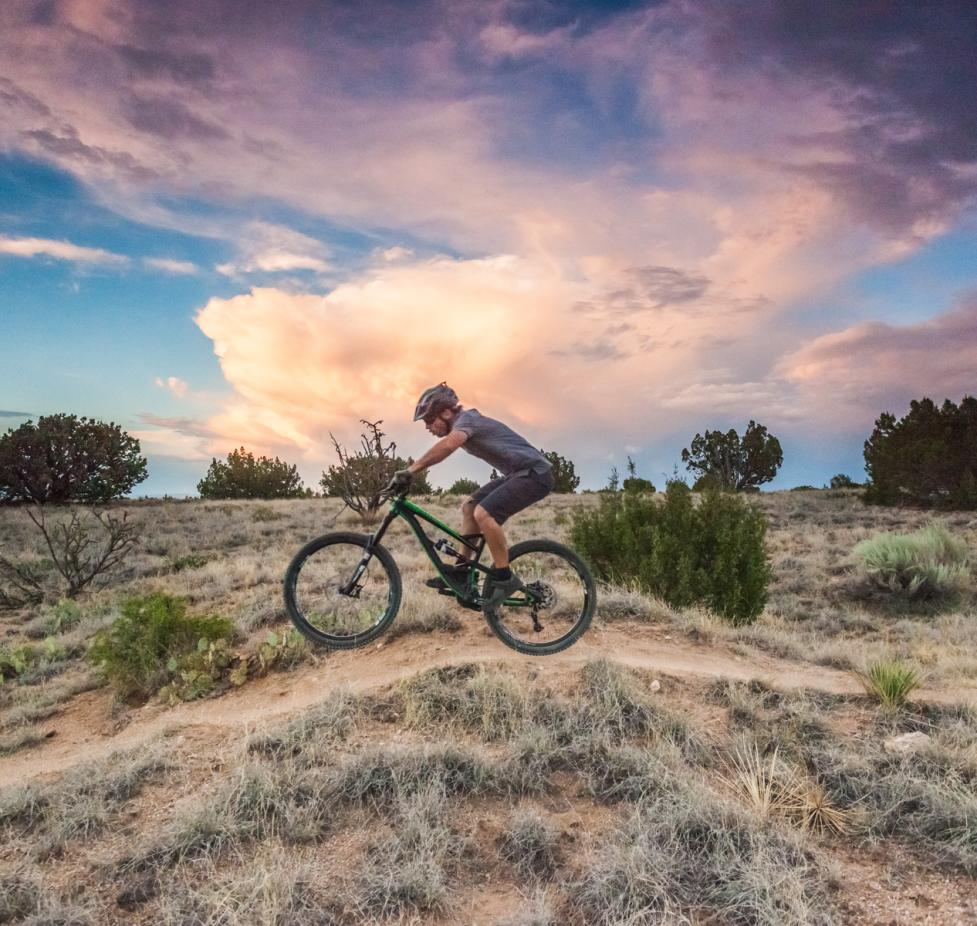
Got an extra day in Albuquerque and already taken care of your bucket list of sites to see? There's nothing like a quick New Mexico day trip to explore the spectacular scenery we're surrounded by in the Duke City. Whether you're looking for culture, history, or just plain fun, you'll find it in all directions from Albuquerque. The city serves as an excellent hub for hiking, biking, escorted tours, and self-guided adventures.
West of Albuquerque
El Malpais National Monument

Photo Credit: Roy Neese
New Mexico is home to 11 national monuments, and several are an easy drive from Albuquerque. While much of New Mexico is at altitude, it's what's high AND low that makes El Malpais National Monument special. The park, 72 miles west of Albuquerque near Grants, has big cliffs and sweeping vistas. It's best known for its lava tubes and lava flows created millions of years ago. There are bats that live at El Malpais, so there may be closures to protect the bats if they're hibernating. There are three exits off of I-40 that take you to different parts of the park; Highway 117 takes you to the cliffs overlooking black basalt lava flows, while Highway 53 out of Grants takes you to lava tubes and park headquarters.
Just outside the park is the privately owned ice cave and 800-foot deep Bandera volcano. The "ice cave" is a collapsed lava tube whose inside temperature doesn't rise above 31 degrees. Admission is $14, $7 for children 6-12.
Acoma Sky City Pueblo
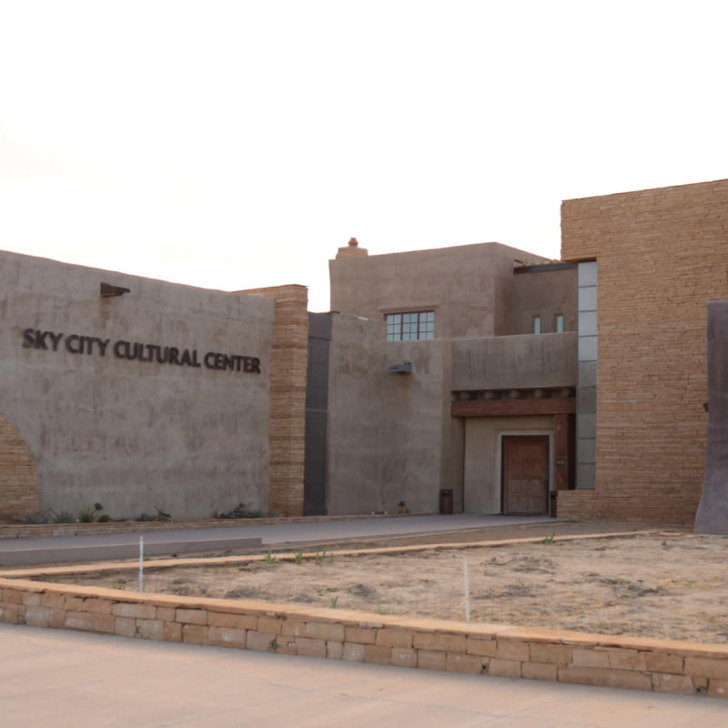
Planted atop a sheer-walled 367-foot mesa, the Acoma Pueblo's Sky City is one of the longest-inhabited cities in North America, dating back to 1150. Protected from invaders by its lofty location and narrow access, it was eventually conquered by the Spanish, who started construction of the San Esteban del Rey Mission in 1629. Both the Mission and Acoma Pueblo are Registered National Historical Landmarks and are on the National Register of Historic Places. The Acoma people are famous for their pottery, and on a tour you'll get to meets the artists and purchase their work.
Sky City can be accessed only by guided educational tours, which start at the cultural center, and a permit must be purchased for photography, which is restricted. Tickets for adults cost $25 per person. Seniors, military and university students pay $22 per person, and children in elementary through high school cost $17 per person.
About 55 minutes west of Albuquerque, take Exit 102 and follow the signs for Acomita/Rest Area and continue on to the Sky City Cultural Center and Haaku Museum, about 15 miles south of I-40.
Petroglyph National Monument
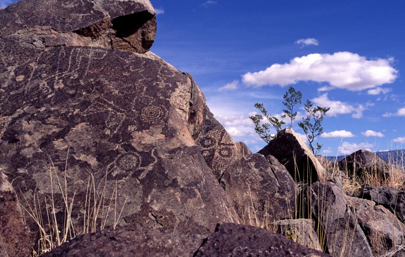
Photo Credit: Verna Wood
On the western edge of Albuquerque, a historical treasure hunt awaits. Petroglyph National Monument, sprawling across multiple sections on the west mesa of the city, contains thousands of images carved into the basalt rocks between 400 to 700 years ago by both Native Americans and early Spanish settlers. Walking off the access trails and up into the rocks turns into a great treasure hunt as the drawings on the rocks come into view.
Start your visit at the visitor center, open 8:30 a.m. to 4:30 p.m. daily at Unser and Western Trail to pick up a map before heading out to one of several trailheads. There are no petroglyph viewing trails within the visitor center area. Piedras Marcadas Canyon off Golf Course Road is a good trail to visit because while it's a bit trickier to get to, it's a quick hike (1.5 miles) with 500 petroglyphs that's a perfect way to introduce visitors to the area. Others include Boca Negra Canyon (three trails, 100 petroglyphs) and Rinconada Canyon (2.2-mile trail, 300 petroglyphs).
On the far western side of the monument, off Atrisco Vista, is access to the Volcanoes Day Use Area, within sight of five ancient cinder cone volcanoes. Be sure to take water no matter what trail you choose to explore.
North of Albuquerque
Valles Caldera National Preserve
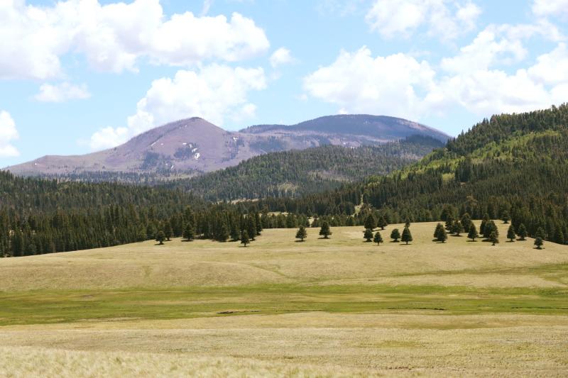
Photo Credit: Facebook
This ancient supervolcano is 13.7 miles wide and holds hot springs, streams, fumaroles and other volcanic features. The Valles Caldera sits at 11,000 feet, west and uphill from Los Alamos. It can be reached from Albuquerque by going north on I-25 to Santa Fe, to the Santa Fe bypass to Española and then following the signs to Los Alamos and 18 miles beyond to the caldera. For a more scenic route, take Highway 550 out of Bernallilo, turn on Highway 4 north, buy yourself some fry bread at stands backdropped by the stunning red rocks of Jemez Pueblo, stop again at the soda dam north of Jemez Springs, then proceed to the caldera 22 miles beyond.
The entrance fee for Valles Caldera is currently being waived, so it is free to enter.
Once at the caldera, there's hiking, wildlife viewing including elk, mountain biking and horseback riding, if you bring your own steed.
Bandelier National Monument
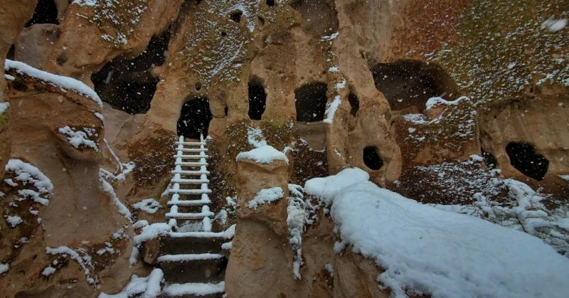
Photo Credit: Facebook
On the way to Valles Caldera, before you get to Los Alamos on Highway 4, is a slice of ancient Native culture in the form of Bandelier National Monument. The 33,000-acre site includes a long steep-walled canyon that holds remnants of Native culture dating back 11,000 years in the form of petroglyphs, walls, reconstructed kivas, viga holes and areas accessible via ladders.
Shuttles run from the White Rock Visitors Center in Los Alamos to the visitor center within Bandelier. Once there, a 1.2-mile loop trails starts at the visitor center. Other trails include the 3-mile Falls Trail to the Upper Falls that includes a view of the ancestral "Long House" pueblo.
There are more than 70 miles of trails in the monument, but some features were erased in a 2011 fire and in subsequent flooding.
Vehicle entry fee is $25 for a seven day pass, and the park closes at sunset.
Santa Fe

Photo Credit: Tourism Santa Fe
Just an hour north of Albuquerque is New Mexico's capital, Santa Fe. The city is full of history and culture. Visit the Santa Fe Plaza in Downtown to see the oldest church in the country and the Palace of the Governors. Santa Fe also has an incredible art scene, including the Georgia O'Keeffe Museum and Meow Wolf.
To get to Santa Fe, drive north on I-25. For a more scenic route, take the Turquoise Trail, which takes you through Golden, Madrid and Cerrillos.
Chaco Culture National Historic Park
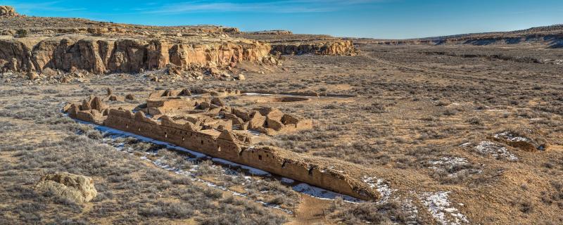
Photo Credit: Andrew Kearns/Facebook
Chaco Culture National Historic Park was once a thriving center for the ancestral Pueblo people from 850 to 1250. Explore the structures and landscape through guided tours, hiking and biking and more. Take the 9-mile long Canyon Loop Drive to see six major sites.
All visitors need to purchase an entrance pass, which is $25 for each private vehicle.
To get to Chaco Canyon, you will have to drive on dirt roads. GPS directions will sometimes lead down unsafe paths or private roads, so be sure to follow the National Park Service's directions on how best to get there.
East of Albuquerque
Madrid
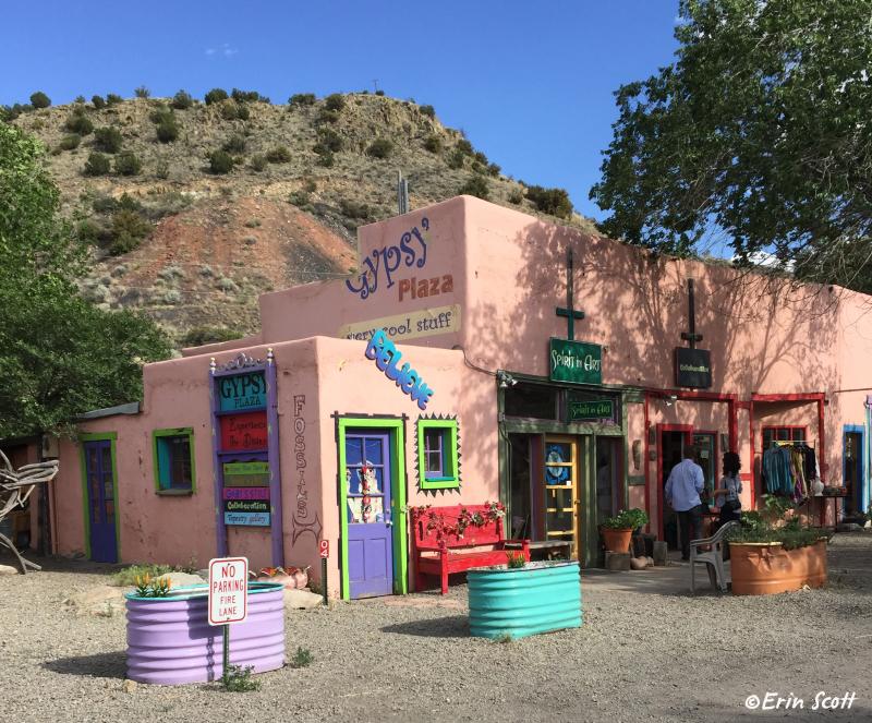
Photo Credit: Erin Scott
Pronounced "MAD-rid," after New Madrid, MO, the funky village was the scene for the movie "Wild Hogs." Whether you're straddling a motorcycle like the good guys in the movie or merely steering your car toward it, Madrid is reached by taking I-40 east of Albuquerque to Tijeras, then north on Highway 14, aka the "Turquoise Trail" that is a back way to Santa Fe.
Madrid, a thriving company coal town in the mid-1800s that had the first lighted baseball field in the West, was headed for ghost town status in the 1970s before the sole owner of the townsite, Joe Huber, started to rent out portions. Since then, it has evolved into its current funky artist colony, hippie-southwest vibe with everything from art boutiques to coffee shops and year-round events.
Part of the fun is the winding road heading north from I-40; you can continue through the Old West town of Cerrillos and its mining museum and trading post, looping back via I-25. If you have time, a side trip early in your journey can take you on a winding climb to Sandia Crest past Tinkertown Museum.
South of Albuquerque
Bosque del Apache National Wildlife Refuge
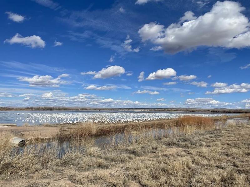
Photo Credit: Facebook/Walker/USFWS
About an hour south of Albuquerque, you'll discover walking trails, world-renowned birding, and spectacular photography opportunities at Bosque del Apache. Try going later in the year when the refuge hosts its annual Festival of the Cranes, which coincides with the sandhill crane migration.
Salinas Pueblo Missions National Monument
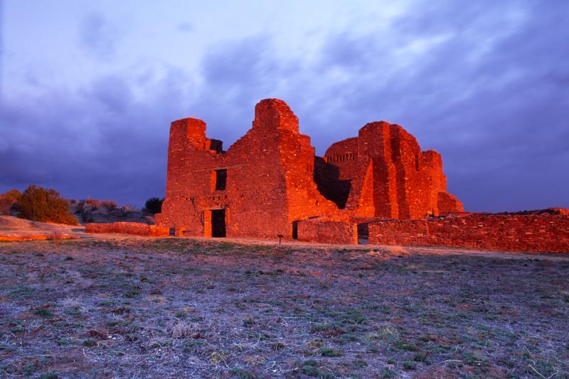
Photo Credit: newmexicostock.com
In Mountainair, about 45 minutes south of Albuquerque, numerous pueblo, kiva, and mission ruins await you at the Salinas National Monument. The abandoned site echoes the early encounters between Pueblo peoples and the Spanish colonizers and are open for exploration (and photo ops) daily.
White Sands National Park
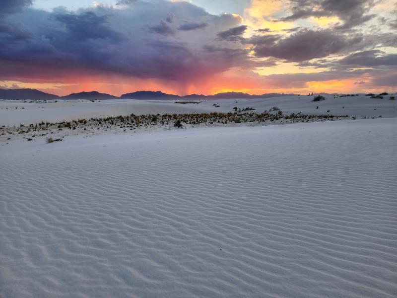
Photo Credit: NPS/B. Powers/Facebook
Don't miss one of the world's greatest wonders at White Sands National Park. Massive dunes of gypsum sand stretch for 275 square miles, making it the world's largest gypsum dunefield. Hike and explore the dunes, and even sled down them! Stop by the visitor center to learn more about White Sands, and view an exhibit detailing fossilized footprints found at White Sands that date back more than 20,000 years.
It costs $25 for each private vehicle to enter White Sands. To get there from Albuquerque, take I-25 south to US-70.
Carlsbad Caverns National Park
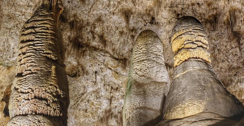
Photo Credit: Carlsbad Caverns National Park
Explore more than 120 caves beneath the surface at Carlsbad Caverns National Park. These caverns were formed when sulfuric acid dissolved limestone. There are two main trails for you to explore Carlsbad Caverns. The Big Room Trail takes about 1.5 hours. The Natural Entrance Trail is steeper and takes about an hour. Bird watchers and picnickers can enjoy Rattlesnake Springs, and hikers can take the Chihuahuan Desert Nature Trail to learn about the desert plants present in the park and see two natural entrances to the caverns. From late May through October, about 400,000 Brazilian free-tailed bats call Carlsbad Caverns home. You can watch the bats leave for the night.
Timed tickets are required to enter Carlsbad Caverns. It costs $15 per person for those 16 and older. Ages 15 and under are free. Carlsbad Caverns is about 300 miles south of Albuquerque.
Spaceport America
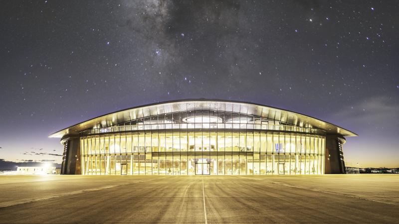
Photo Credit: Facebook
Take a drive 180 miles south of Albuquerque to Spaceport America. This facility serves as a launching point for space-bound aircrafts as well as a place to land. In June 2023, Virgin Galactic began monthly spaceflights out of Spaceport America. You can book a private tour, but otherwise the facility is closed to the public. Visit Spaceport America's visitor center in Truth or Consequences to learn more.
To get to the Geronimo Trail Visitor Center, take I-25 south and take exit 79.